| home | mission | membership | |
| fyi | gift ideas | paumanok path | long island trail lovers coalition |
| links | path partners | explore | |

|
|
|||||||||||||||
| Back by popular demand .... the East Hampton Trail Maps! | ||||||||||||||||
Denis and Catherine Krusos Ecological Research Area
Calverton
Suffolk County, NY
350 Acres
Coastal Plain Ponds, Barrens
****Some of the following text is from the interpretive brochure that is usually available at the kiosk by the Old River Road entrance****
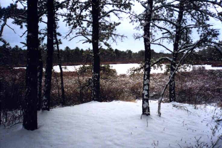
This 350-acre assemblage of Pine Barrens and Coastal Plain Ponds comprises one of the rarest and most fragile wetland ecosystems in North America. The preserve is cooperatively owned and managed by The Nature Conservancy and Suffolk County Parks.
Calverton Ponds and the headwaters of the Peconic River contain one of the highest concentrations of rare and endangered species in New York State, with more than 30 rare plants, including three that are globally threatened. The Ponds are home to several rare amphibians, fish, and insects, including the Tiger Salamander and Banded Sunfish.
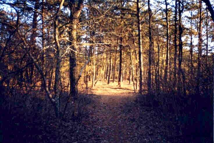
The preserve is located within the Long Island Central Pine Barrens Region, which consists of a complex mosaic of Pitch Pine woodlands, pine-oak forests, Coastal Plain Ponds, swamps, marshes, bogs, and streams. Pitch Pine and Oak trees, with a shrub layer of Scrub Oak, Huckleberry, and Blueberry dominate the woodlands.
Coastal Plain Ponds are characterized by nutrient poor, acidic water and a gently sloping shore. Most Coastal Plain Ponds are not stream-fed, but are directly connected to groundwater. Pond water levels rise and fall with the water table, reflecting seasonal and annual rainfall patterns. Consequently, a unique community of plants grows along the pond shores. Periods of both low and high water levels are essential for their survival.
****Pond shore plants are delicate and easily destroyed by trampling, pets, horses, or vehicles. Please be careful not to disturb plants or wildlife.****
 |
 |
VISITATION
Well marked, easy to follow trails are open for hiking and observing nature daily from dawn to dusk. No other uses are permitted. Trails are maintained for foot travel only. PLEASE DO NOT DISTURB PLANTS OR WILDLIFE. No pets horses or vehicles are allowed. Groups are limited to 25 persons and should call for reservations. "A WALK IN THE PRESERVE"
An international, non-profit organization dedicated to preserving the plants, animals, and natural communities that represent the diversity of life on Earth by protecting the lands and waters they need to survive. Since 1951, the Conservancy has protected more than 10,000,000,000 acres of ecologically-significant land in the U.S., Canada, Caribbean, Central and South Americas, and Pacific region.
The Nature Conservancy owns 63 nature preserves on Long Island. In partnership with government and other organizations, the Conservancy named eastern Long Island one of the “Last Great Places” in the Western Hemisphere.
****YOU CAN HELP!****
For information about membership and the Conservancy, please contact:
The Nature Conservancy
Cold Spring Harbor, New York 11724
Telephone:
Visit The Nature Conservancy web site at www.tnc.org
The first few times I visited the Calverton Ponds Preserve I got lost. That is why the following directions are so explicit. The preserve is close to an access point to the Paumanok Path. This is another excellent reason to become familiar with this area. There is Department of Environmental Conservation land nearby, so it is important that you become acquainted with the DEC permit conventions and rules. You will find information about obtaining the free permit on this web site. Look “under” the For Your Information button on the Hike-LI web site to see how easy it is to apply for the permit.
Click on Map to see larger map
To get back here, use Browser's BACK button
*From the Long Island Expressway:
Take Exit 70, Manorville-Eastport (CR 111). At the end of the off-ramp, go north. (YOU WILL PASS THE MANORVILLE TRAIL INFORMATION CENTER ON THE RIGHT SIDE OF THE ROAD. VISIT THIS PLACE; IT IS A GREAT RESOURCE FOR L.I. HIKING INFORMATION) Travel 0.25 miles to Ryerson Ave. (The Manorville Post Office is on the corner.) Go right on Ryerson, crossing railroad tracks, 0.2 miles to North St. Go right on North St. for 0.2 miles. Road curves to the left, becoming wading River Manor Rd. Follow Wading River Manor Rd. north 0.8 miles to Old River Rd. (Not River Road). Go right on Old River Rd. 0.4 miles to the small parking area on the left (with the wooden gate)
*** please don’t block the gate ****
*From Middle Country Rd. (Rte. 25):
Approximately 3 miles east of the William Floyd Parkway (Rte. 46), and a mile east of The Pine Trail Nature Preserve parking lot, at traffic light make a right turn onto Wading River Road. Travel south for less than a mile then bear left onto Grumman Blvd. Continue in an easterly direction for one mile, and then make a right turn onto Line Road. After a little more than 1 mile you will find a chain strung across two posts on the left side of the road. It is easy to miss this entrance, if you reach Wading River Road, you have passed it. There is almost a quarter of a mile of level shoulder to park on opposite this entrance, therefore I suggest parking here. Both the DOT & the local police departments have cautioned me that it is important, when parking in preparation for a hike, that you be certain that your car is not on private property and that all four tires are off the pavement.
Follow the trail markers and eventually you will reach the main entrance on the opposite side of the preserve by Old River Road. There is a kiosk recessed a few hundred feet inside the preserve. At the kiosk, you will usually find some interpretive brochures that include a trail map.
*If you wish to enter the preserve from the main entrance off Old River Road:
A small stream that helps feed the headwaters of the Peconic River runs under Old River Road. You will see a white wooden guardrail on either side of the road, where the stream flows underneath. Just east of this stream, you will see two gates on the left side of the road. The wooden gate is in front of the formal trail system.
The parking on Old River Road is awkward. If you wish to park on the preserve side of the road you can park at the entrance, but you should be careful not to block the access gates. Opposite this entrance, the shoulder of the road is very steep and hard to park on. Further down the road there are no trespassing signs. I suggest parking by the Line Road entrance (see directions from Middle Country Road).
*If you wish to hike from the Nature Conservancy preserve to the Paumanok Path:
From Line Road, head south to Wading River Manor Road where you will make a left (heading east). Pass by River Road, which you will see on the left. On the Right side of the road, not far from the Wading River Manor road sign you will find the entrance to the Paumanok Path heading west. If you continue over the bridge, which runs across the Peconic River, you will find the entrance to The Path heading in the easterly direction. It is best to cross over to the east side of the road (in this case the left) because it will be easier to see the white rectangular blazes that mark the route of the Paumanok Path as it continues eastward.
|
Copyright © 1999/2000/2001/2002/2003/2004 Hike-LI.com All rights reserved. |
Ken Kindler |
|
|
Web site design and management by Web Strategies |
||