|

|
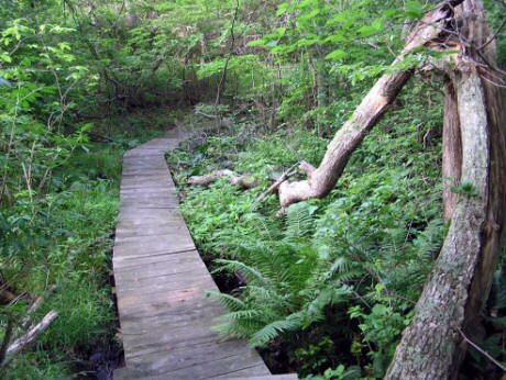
Just east of Lake Montauk on the northwest corner of Theodore Roosevelt County Park, there is an adventure awaiting you through what I like to refer to as “Montauk’s Rainforest.” The Big Reed Pond Nature Trails at Theodore Roosevelt County Park run adjacent to Big Reed Pond and through much of the wetlands that feed it. Every year just as summer begins, I walk these well-maintained trails with their expertly built boardwalks and bridges. Time seems to stand still while I visit these picturesque freshwater ponds, swift running brooks, red maple swamps, the salt marsh and the hardwood forest.
Several years ago, after studying Charles Whalen’s Montauk Point Trail Guide*, I decided to set out on an adventure to visit Block Island Sound from the Big Reed Pond trailhead on East Lake Drive. Whalens’ map shows a woods road that runs to the isthmus that separates the Sound from Oyster Pond. This is a heavenly destination for anyone who loves the water.
|
The first time I decided to visit the Sound via the Big Reed Nature Trails, I followed the map furnished by Suffolk County Parks**, and decided to take the trail that skirts the Pond to the east, and then branches north to the beach. I couldn’t find the trail to the beach. Using my compass, I followed several trails headed north towards Shagwong Point, but all of the trails disappeared into the dunes. The dunes are fragile and walking through them, especially where there is no path, unduly stresses them so I turned back. Luckily, in addition to the County Parks map, I had also brought along Charles Whalen’s map of Montauk Point. It showed a trail to an area called “The Songbirds”, located right near the Sound. This is the trail that I have become accustomed to using to get to the beach. Unfortunately, a portion of it was washed away by last winter’s storms, and this week, when I walked it again, I found that it now dead-ends on a bluff. I wandered around until I found a route to the beach on a newly built horse trail. By the way, it’s important to know that people on horses often use the trails adjacent to Big Reed Pond Park. When you encounter equestrians, it’s a good idea to greet them and then move off the trail and allow them to pass; the horses may get spooked if you move too quickly and do not give a friendly greeting first.
If you are into adventure and willing to take a risk, I recommend that you give this beach hike a try. If you want a more tame experience, I suggest you obtain a map from Suffolk County Parks and walk the three loop trails. These loop trails are well blazed, the maps are displayed on kiosks throughout the trail system, and easy to follow. The trails are each marked with a different color: blue; green; and brown. You must hike the blue loop trail in order to get to the green loop trail. You may hike only the blue trail loop if you wish; it is a complete circle that will bring you right back to the trailhead. Approximately half way around the blue loop trail, you will see where the green loop trail begins. You can take the green loop back to the blue loop, or if you are looking for a longer hike, you can follow the green loop trail to where it intersects with the brown loop trail. The blue loop trail is 0.9 miles. The green loop trail is 0.5 miles. The brown loop trail is 1.3 miles. If you decide to walk all three loops, it’s important to know that in order to get back to the trailhead, you must follow the brown loop to the green loop trail and the green loop trail back to the blue loop trail. The blue loop brings you back to the trailhead.
Directions to the Big Reed Pond Nature Trails: Montauk Highway to East Lake Dr. Go north on East Lake Dr. for approximately two miles. The trailhead entrance is on the right. Follow the dirt road to the parking area.
* Charles Whalen’s maps are available at most east end cycling and outdoors stores.
Another excellent resource for exploring this area and the lands adjacent to it is Charles Whalen’s East Hampton Trail Guide.
**Suffolk County Parks Administration Office: or Theodore Roosevelt County Park Office:
|
